Do You Have A Potential Solar Site?
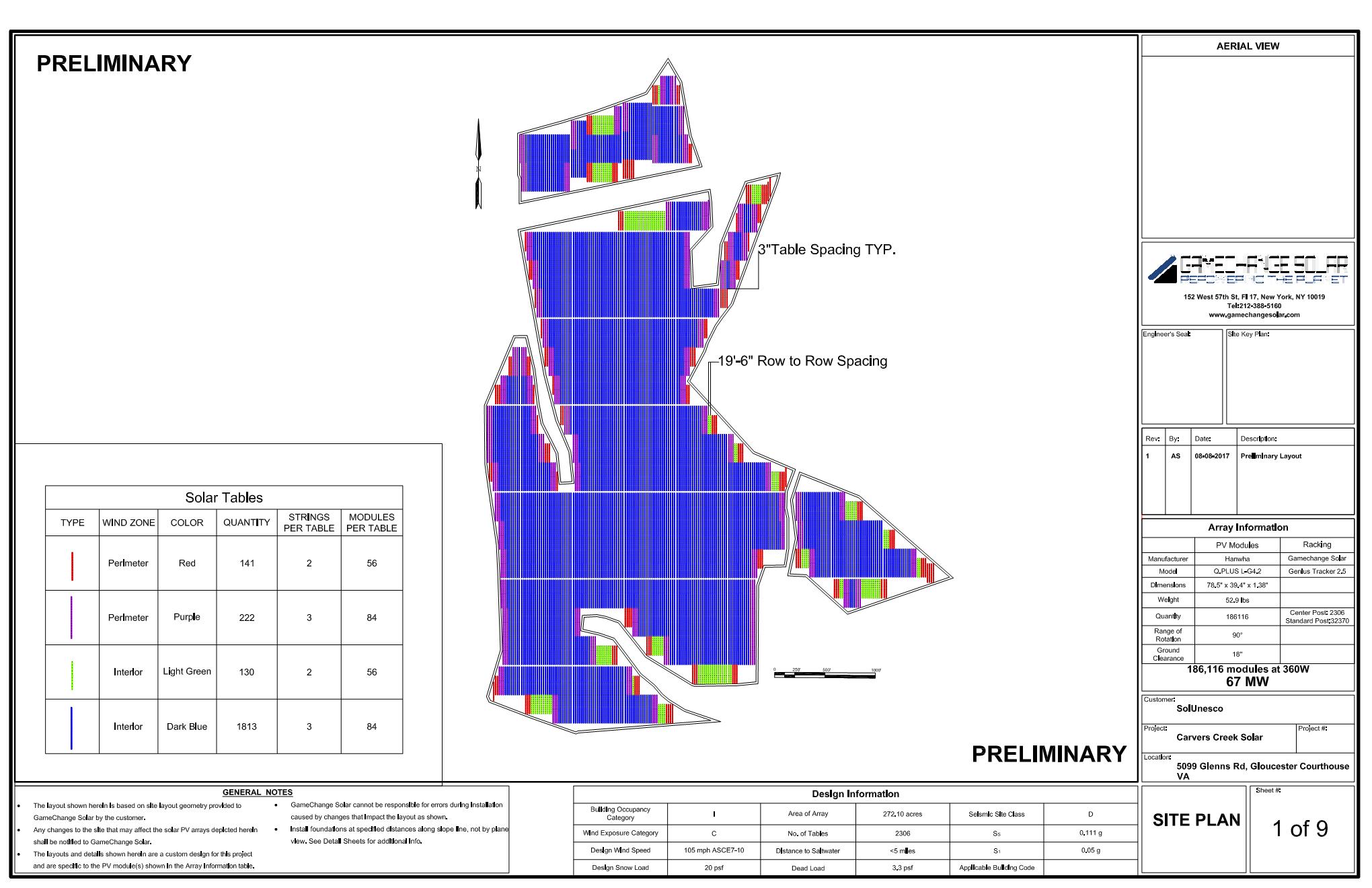
Carvers Creek Solar
- The Carvers Creek Solar Project consists of two phases, Phase 1 is 50 MW and Phase 2 will be 100 MW. Phase 1 uses 310 out of 402 contracted acres. Phase 2 is still in site control process.
- SolUnesco sold the project rights to Apex Clean Energy and executed a Development Services Agreement. SolUnesco retains day-to-day project development responsibilities including landowner relations, community relations, site diligence, vendor management, local, state and federal permitting, support of the interconnection process, and support for commercial offtake agreements.
- Phase 1 of this project has been entered into the PJM queue (Position AD1-041) at 50MWac, and Phase 2 will consist of two separate interconnection queues that will be combined with the Phase 1 interconnection. The project will interconnect to a Dominion 115kV line located on the property. This project has achieved full site control, with a five-year option to purchase. The subject property is zoned RC-1 and is therefore granted permit-by-right status for utility-scale solar development in the county. Once complete this project will provide power to the wholesale electricity grid and either sell directly to a large customer, the utility, or the utility may purchase the project, adding this competitive, fixed priced power to their portfolio of power generation.
Status
- Interconnection: Phase 1 Facilities Study is underway in the AD1 Queue. Phase 2 Facilities Studies are underway in the AE1 Queue.
- Permitting: The project is sited on land that is zoned RC-1 in Gloucester County and is designated Permit By Right and the county has provided a confirmation letter.
- Site Diligence: Timmons Group has conducted the following desktop analyses on the Phase 1 project site: 1) Virginia Department of Historic Resources (VDHR) cultural resources database search; 2) Virginia Department of Game and Inland Fisheries (VDGIF), Virginia Department of Conservation and Recreation (DCR), and the United States Fish and Wildlife Service (FWS) database searches for the presence of Rare, Threatened or Endangered (RTE) species within a 2-mile radius of the project; 3) compile database information for topography, wetlands, National Hydrography Dataset, soils, etc. and 4) a high-level overview of interconnection feasibility. These analyses determined the site conditions support an economically attractive project.
Project Details
SIZE:
50 MWac / power the equivalent of ~ 32,500 homes
LOCATION
Gloucester County, VA

